


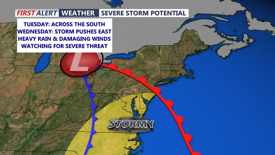


DELMARVA - A major storm system is set to sweep through Sussex County and the Delaware coast, bringing periods of heavy rain, strong winds, and a risk of severe thunderstorms from Tuesday morning through late Wednesday.
A strong low-pressure system will approach from the west Tuesday, tracking into the Great Lakes before pushing a cold front through the Mid-Atlantic Wednesday night. Coastal communities can expect a prolonged period of high winds and heavy rainfall, with the strongest storms expected Wednesday afternoon into the evening.
Storm Timeline and What to Expect
Tuesday Morning to Afternoon:
- Clouds increase, with a few scattered showers developing in Sussex County and along the coast.
- Breezy conditions begin, with winds increasing to 15-25 mph.
Tuesday Evening into Overnight:
- Steadier rain moves in, becoming heavy at times.
- Winds strengthen, with gusts reaching 30-40 mph along the coastline.
- Coastal flooding concerns begin, especially in low-lying areas.
Wednesday Morning to Afternoon:
- Heaviest rain arrives, with potential for flash flooding.
- Damaging wind gusts of 45-50 mph expected near the coast.
- A line of strong thunderstorms could develop, with an isolated tornado threat.
Wednesday Evening into Late Night:
- The cold front moves through, gradually bringing an end to widespread rain.
- Winds remain strong, shifting west-northwest with gusts 30-40 mph lingering.
- Temperatures drop into the 40s overnight.
Threats and Safety Measures
The biggest concerns with this system include:
- Strong winds capable of knocking down trees and power lines.
- Heavy rain leading to localized flooding, especially in poor drainage areas.
- Severe storms with potential tornadoes, particularly Wednesday afternoon.
How to Prepare:
- Secure outdoor items to prevent wind damage.
- Charge devices in case of power outages.
- Avoid flood-prone roads and use caution while driving.
- Stay updated with real-time alerts by downloading the CoastTV Weather App.
While conditions will improve by Thursday, gusty winds will persist, making for a blustery end to the week. Stay weather-aware and prepare now as this strong system moves in.