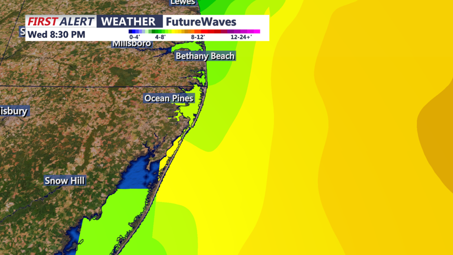


DELMARVA - As a secondary coastal low develops off the coast of Cape Hatteras this evening, it will move northward, paralleling the coastline through Wednesday. Although there has been some uncertainty with the storm's track, recent model guidance suggests the low will stay just offshore, keeping the heaviest rain away from Delmarva.
Late tonight, expect light showers to begin spreading across Delmarva, particularly in southern areas. With a cool and dry northeast flow persisting, most locations north and west of Philadelphia will remain dry overnight under mostly cloudy skies. Low temperatures will range from the mid-50s to mid-60s.
On Wednesday, the low's approach will bring more scattered showers to Delmarva, with the highest likelihood of rain along the immediate coast due to enhanced coastal convergence. Some heavier rain pockets may extend inland, potentially reaching as far west as the I-95 corridor. However, northern and western parts of the region could stay mostly dry. Rainfall amounts will generally range from 0.10 to 0.50 inches, with up to 1 inch possible near the coast. Given recent dry conditions, the threat of flooding is low, and no excessive rainfall is expected for the area.
Be prepared for wet conditions along the coast and stay updated on any changes to the forecast as the low progresses northward.