


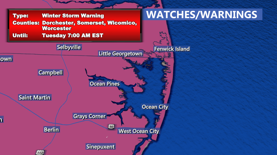

DELMARVA - As the second wave of snow moves through Delmarva late Monday evening, forecasters anticipate another 1-2 inches of accumulation in southern New Jersey and across the Delmarva Peninsula. Areas that experienced mixed precipitation or ice earlier, particularly in Sussex County, Del., are expected to transition back to all snow before the storm exits around 1 to 2 a.m.
While the snow will clear out overnight, residents should prepare for intensifying winds as a strengthening pressure gradient develops between the departing storm system and an Arctic high-pressure system approaching from the west. These winds will cause blowing and drifting snow, reducing visibility on roadways. Temperatures overnight will dip into the teens, but wind chills will make it feel as much as 10 degrees colder, prompting a Cold Weather Advisory.
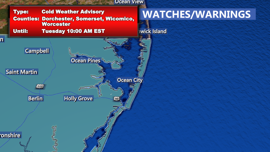
What the Cold Weather Advisory Means
The Cold Weather Advisory is issued when dangerously cold wind chills and weather conditions pose a risk to public safety. On Monday night into Tuesday morning, wind chills across Delmarva will drop into the single digits to low teens, significantly increasing the risk of frostbite and hypothermia for those exposed to the elements for prolonged periods. Residents are advised to wear layers, limit outdoor activities, and ensure pets are protected from the cold.
Drivers should remain cautious, as blowing snow will reduce visibility and create hazardous travel conditions. Additionally, the gusty winds—reaching up to 40 mph—will lead to drifting snow, especially in open areas, complicating road clearing efforts.
Cold and Windy Days Ahead
Tuesday marks the beginning of an extended period of Arctic air over the region. High temperatures will struggle to reach the upper 20s to low 30s, with wind chills remaining in the single digits to teens. Northwest winds at 15-25 mph, with gusts between 35-40 mph, will prolong issues with blowing and drifting snow. Skies will be mostly sunny over Delmarva, but the cold temperatures and brisk winds will make conditions feel much colder.
Residents should plan for bitterly cold mornings through the week, with overnight lows in the teens and daytime highs staying well below freezing.